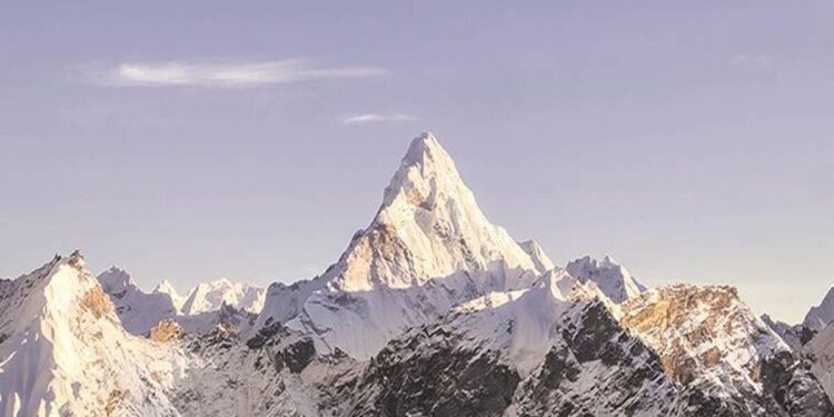
 The Survey of India had determined the previous height of Mount Everest back in 1954.
Mount Everest height: For years, we have studied the height of Mount Everest to be 8,848 metres. However, that is now set to change as the Foreign Ministers of both China and Nepal jointly certified that Everest is 8,848.86 metres tall, making it taller by 86 centimetres. The previous height of the mountain had been recognised since 1954, according to a report in IE. The change in the height due to joint certification has brought an end to a long-standing debate on the elevation of the mountain between China and Nepal, of which, the former had been claiming that the Everest was 8,844 metres or 29,017 feet, while the latter said that the mountain was 8,848 metres or 29,028 feet tall. However, the new height makes Everest 29,031 feet tall, 3 feet taller than Nepal’s claims.
Over the years, the mountain has been the subject of several debates, including whether the height should be calculated through rock height or the snow cladding it should also be considered, the report added.
Details about the previous measurement
The Survey of India had determined the previous height of Mount Everest back in 1954. Since GPS technology was still decades away, the measurement had been done using theodolites and chains. Due to this, this measurement was accepted by all countries across the world except China. The mountain originates from the Nepal-China border.
A third estimate carried out by a team sponsored by US’ National Geographic Society in 1999 measured the elevation of the mountain to be about 8,850 metres or 29,035 feet. While the Society uses this measurement, the rest of the world, barring China, had accepted the height to be 8,848 metres.
New measurement
A devastating earthquake in April 2015 triggered debates amongst scientists on whether the height of Mount Everest was affected by it or not, after which the country’s government declared that it would conduct its own measurement of the mountain instead of relying on the previous one. In this mission, Nepal was aided technically by New Zealand, which shares a bond with the nation over the mountain, as the first climbers on the mountain had been Nepal’s Tenzing Norgay and New Zealand’s Sir Edmund Hillary.
New Zealand then provided trained technicians and a Global Navigation Satellite to Nepal in 2019 for the mission.
China’s inclusion in the project
China measured the mountain separately. While Napal’s mission had been completed early last year, the processing of data by analysts and field workers took four months before the pandemic caused a disruption.
After this, both the nations signed an agreement to jointly release their results. China conducted its measurements early in 2020.
Methodology of new measurement
In the webinar conducted on Tuesday, the Foreign Ministers of the two nations only announced the results. The technical details were not visited by them.
However, the report quoted Nepal Department of Survey Joint Secretary and Spokesperson Damdar Dhakal as saying that the measurements were conducted using previous methods as well as the latest data generated with the help of Global Navigational Satellite System (GNSS). Dhakal added that the tallying of results of China and Nepal demonstrated the accuracy of measurement.
Get live Stock Prices from BSE, NSE, US Market and latest NAV, portfolio of Mutual Funds, calculate your tax by Income Tax Calculator, know market’s Top Gainers, Top Losers & Best Equity Funds. Like us on Facebook and follow us on Twitter.
![]() Financial Express is now on Telegram. Click here to join our channel and stay updated with the latest Biz news and updates.
Financial Express is now on Telegram. Click here to join our channel and stay updated with the latest Biz news and updates.


